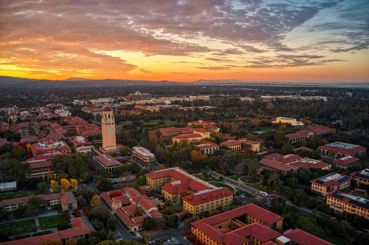
The intellectual capital of Silicon Valley — a leafy, walkable city built around Stanford University and a century of innovation.
Palo Alto is one of the most influential cities in the world. It's the birthplace of Silicon Valley, the home of Stanford University, and the city where Hewlett-Packard, Tesla, VMware, and dozens of other major technology companies were founded or headquartered. Apple, Google, Meta, and Yahoo all began with people who lived, studied, or worked here. Yet for all its global influence, Palo Alto remains, day-to-day, a quiet residential city of tree-lined streets, more than 30 parks, and one of California's top public school districts.
The city was founded in 1894, in tandem with Stanford University, which had opened on adjacent land three years earlier. The relationship between Stanford and Palo Alto has defined the city ever since — from the founding of Hewlett-Packard in a Professorville garage in 1939 (a National Historic Landmark and the official "Birthplace of Silicon Valley") to the venture capital firms of Sand Hill Road and the present-day campuses of Stanford Research Park. The city was originally developed from north to south, beginning around University Avenue, and incorporated the neighboring town of Mayfield (now the area around California Avenue) in 1925.
Palo Alto has consistently ranked among the most expensive and most competitive housing markets in the United States. Its neighborhoods range from historic, tree-canopied streets in Old Palo Alto and Crescent Park to mid-century Eichler tracts in South Palo Alto and the bucolic, semi-rural feel of Barron Park.
Palo Alto has the feel of a college town crossed with one of the most influential business hubs in the world. Residents include Stanford faculty and students, longtime Bay Area families, and the founders, executives, and investors who shape Silicon Valley. The city is genuinely walkable in many neighborhoods, with tree canopies, sidewalks, bike lanes, and weekend foot traffic that fills the cafes along University and California Avenues. Most residents take advantage of the parks, the Stanford Dish, and the Baylands trails for daily outdoor recreation.
Palo Alto's dining scene is among the best on the Peninsula. Local favorites include:
Palo Alto has two distinct downtowns. University Avenue is the main commercial corridor — a walkable strip of restaurants, bars, boutiques, and the Stanford Theatre. California Avenue, the historic heart of old Mayfield, is a quieter second downtown known for its weekly Sunday farmers' market — one of the largest and oldest in the Bay Area — and a strong independent restaurant scene.
The Stanford Shopping Center, just north of campus, is one of the most upscale outdoor malls in California, anchored by Bloomingdale's, Neiman Marcus, Nordstrom, Tesla, and Apple. Town & Country Village across from Palo Alto High School offers a more local mix of shops, restaurants, and weekly community events.
Palo Alto has more than 30 parks and one of the most extensive trail systems in Silicon Valley. The Baylands Nature Preserve covers nearly 2,000 acres of marshland with miles of walking and biking trails — one of the largest tracts of undisturbed marshland on the San Francisco Bay. Foothills Nature Preserve in the western hills offers hiking and panoramic views.
The Stanford campus is itself one of the city's biggest attractions, with the Cantor Arts Center, the Anderson Collection, the Hoover Tower, and the Stanford Dish all open to the public. The Elizabeth F. Gamble Garden in Old Palo Alto, once the family estate of the Procter & Gamble heiress, is a 2.5-acre community garden and event space open daily.
Downtown highlights include the Stanford Theatre — a beautifully restored 1925 movie palace showing classic Hollywood films — and the Palo Alto Art Center on Newell Road. The Palo Alto Junior Museum & Zoo is one of the most beloved family attractions in the city.
Palo Alto Unified School District is consistently ranked among the top public districts in California. Students may attend:
67,231 people live in Palo Alto, where the median age is 42.5 and the average individual income is $121,565. Data provided by the U.S. Census Bureau.
Total Population
Median Age
Population Density Population Density This is the number of people per square mile in a neighborhood.
Average individual Income
There's plenty to do around Palo Alto, including shopping, dining, nightlife, parks, and more. Data provided by Walk Score and Yelp.
Explore popular things to do in the area, including Alison Plaza, Palo Alto Playing Fields - Stanford, and SiliconValleyFit.
| Name | Category | Distance | Reviews |
Ratings by
Yelp
|
|---|---|---|---|---|
| Shopping | 1.57 miles | 0 reviews | 0/5 stars | |
| Active | 1.24 miles | 1 review | 4/5 stars | |
| Active | 1.53 miles | 3 reviews | 4.7/5 stars | |
| Active | 1.56 miles | 9 reviews | 5/5 stars | |
| Active | 1.56 miles | 0 reviews | 0/5 stars | |
| Active | 1.65 miles | 0 reviews | 0/5 stars | |
|
|
||||
|
|
||||
|
|
||||
|
|
||||
|
|
||||
|
|
Palo Alto has 26,054 households, with an average household size of 2.55. Data provided by the U.S. Census Bureau. Here’s what the people living in Palo Alto do for work — and how long it takes them to get there. Data provided by the U.S. Census Bureau. 67,231 people call Palo Alto home. The population density is 2,795 and the largest age group is Data provided by the U.S. Census Bureau.
Total Population
Population Density Population Density This is the number of people per square mile in a neighborhood.
Median Age
Men vs Women
Population by Age Group
0-9 Years
10-17 Years
18-24 Years
25-64 Years
65-74 Years
75+ Years
Education Level
Total Households
Average Household Size
Average individual Income
Households with Children
With Children:
Without Children:
Marital Status
Blue vs White Collar Workers
Blue Collar:
White Collar:
This is an important financial decision. I have the experience, knowledge and heart to help you make the right moves. We will seamlessly handle your transaction, and educate you along the way.
ContactCompass
270 3rd St Los Altos, CA 94022